Wednesday, July 31, 2013

Day 35 - Into Darby!

July 23rd
4 Miles

We woke up ready for town and gunned it to Lost Trail Pass so that we had plenty of time to get breakfast in Darby. When we arrived at the pass and started hitching nobody was slowing down to pick us up. After a half hour Flyboxer came down to the pass and hung out until we got a ride. After about an hour and fourth five minutes of blanks states from Idahoans driving by, a guy with his two children squeezed us into his truck and we made it to Deb's Restaurant just in time for breakfast and it was huge portions, tasty home cooked food, and really really friendly service. We loitered around in our rain gear while doing laundry and then the rest of the town chores were taken care of and we got a cabin for the night. Dinner was at the other place to eat in town, the Little Blue Joint, which had a stellar burger and really creative and delicious pizzas. Darby is a cool little western town, not much here but what is here is nice and friendly.

Wednesday, July 24, 2013

Day 34 - Bored and Beat Up

July 22
23.1 Miles
Four Miles Before Lost Trail Pass

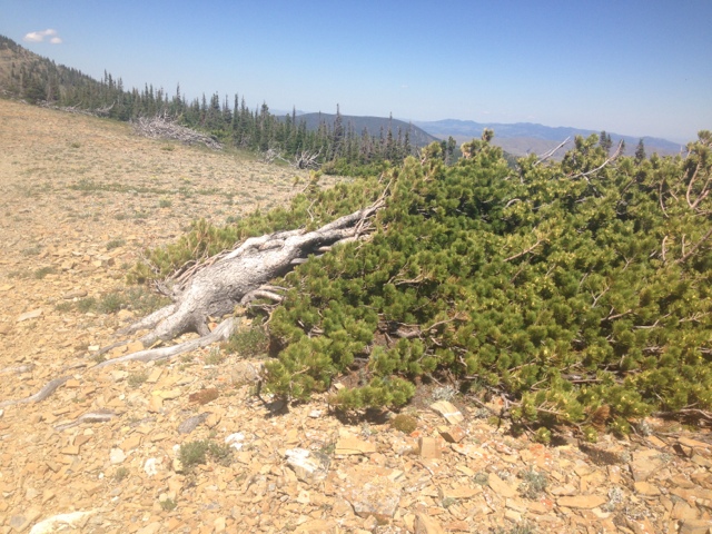
The morning was a slow start for Spins, myself, and Flyboxer who was camped up the hill from us. There was a small uphill this morning and then we got water for the first eight miles of waterlessness. The smoke from yesterday cleared which is a good sign that the fire is a decent distance away from us still. The hike turned into burn area yet again and stayed that way up until lunch at the only water source for the day. 

I took a nice long lunch with Spins and Flyboxer and slammed as much water as possible and cooked my lunch so I didn't have to carry cooking water later in the day. Burn area and waterlessness was the theme of the day. After lunch there were three potential spots all down steep inclines off trail at three, nine, and ten miles away from the lunch spot respectively. Being the risky dumbass I am sometimes, I only took two liters of water figuring there would be some in three miles. Being the risky dumbass I am sometimes, I also chugged one liter right before the three mile off trail water spot. We got there I ventured and nada....no water. Well shit, one liter of water and six miles until the next source. 

Dehydration kicked in and with the lack of water so did chaffing and my feet started to get the salty sweat rash they've had recently. Blisters I can do but the friction burns on all my toes and the bottoms of my feet are making hiking really really painful. I've been taping up my feet, stream cleaning my socks everyday,and swallowing ibuprofen like a champ but I think a good old town washing and shower will do the trick. 

So more boring burn area until six miles later where I was hot and dehydrated and walked down some steep thick brush with blowdowns everywhere to find no water. I was pissed......and thirsty. Could the third water source be the charm? Don't know because I did't waste my time bushwhacking to find out. By this time my feet were wrecked so I stopped changed socks and retaped my feet. Three miles from where I stopped was a Gibbons Pass that had a dirt road junction that led of trail to a main creek. So I went on along waterless by this point to the pass, down the road, and had dinner at the water. The fire smoke was thickening by now and the sun was making the sky quite colorful, possibly the only interesting thing of the day. After dinner Spins and I hooked back on the CDT and hiked until we were four miles from the road to take us into town. Going to get up early, nail that four miles, and hitch into Darby, MT in time for some breakfast. Today was blah and kind of sucked but you'll have those days sometimes. Woo Hoo town tomorrow for Spins' and Flyboxers' day early birthday celebrations!!


Day 33 - Burned to Burning

July 21
22.5 Miles
Surprise Lake

With an early finish last night I got plenty of sleep and woke up early ready to go. I left camp around 6:40 and it was chilly but going uphill over Pintler Pass warmed me up a little. Going up the pass was beautiful just like the previous few passes in the area and what lie ahead looked lower, more forested, and boring. Coming down the pass there were a few turns which were pretty well hidden if you weren't paying close attention. Spins and I were able to make it through without losing our way thankfully. A slow and steady climb up onto the Continental Divide was scenic and then we lost elevation and went down into burn area. Boring drab I excited burn area. We were still on the divide but it was not terribly exciting and dropped down off the divide at the areas only water for lunch.

Going back up on the divide merged into forested area for a short while and we went gained elevation for quite a while before heading back down again. We entered burn area again and low and behold in the sky was a long lingering and drifting cloud from up ahead. Now Spins in this section has said that it smelled like the PCT and I figured it was grilling the first day at storm creek but now I've come to realize that lovely PCT smell is most likely a fire that we now see ahead of us up over the ridge in the distance. The smell is faint and no ash is raining down so we figure its still a bit away and after some fun 'find your own way up the burn area ridge' we got back on trail and headed towards the smoke. While going down for the day the smoke is still a good distance away so it keeps the mind at ease and the wind isn't blowing in this direction from it. Hopefully tomorrow we still don't have to deal with the fire but we'll see. 


Day 32 - Going Up to Go Down to Go Up...

July 20
19 Miles
Johnson Lake

The morning started off cold but with the help of some coffee I got out by quarter to eight. There was a short downhill and followed by the first pass of the day to get over named Cutaway Pass. It went by rather quickly and the scenery going up was fantastic. Crossing over down into the valley took a short bit of time and since we went down, we started going right back up towards (walden) Lake where I had lunch. The last three tenths of a mile were up short steep exposed switchbacks which made it hot as hell and I was ready for a dip in the lake but unfortunately the lake was shallow, may e next time. After hanging around the lake in the sun baking, leaving up over a small pass, I really started to feel an energy drain. The sun was pretty hot but not anything more than usual. I was pretty out of it. Maybe it was all the food I ate at lunch trying to coerce me into an afternoon nap or maybe it was being a bit dehydrated but I was foggy, tired, and spaced out. I pounded a good but of water over the course of the next few hours and the sun's power wore off a bit and I started to feel normal again. 

Heading up towards Rainbow Lake was done in a daze but the mountains surrounding the lake were epic just as the last few lakes. The other nice thing about the Anaconda Pintler Wilderness is the availability of water. After being in dry flat road walking stretches its nice to be in mountains with water flowing everywhere. The trail snaked around Rainbow Lake and went up just like the others through an nice exposed area covered in beargrass and I made it up to Rainbow Pass at 9250 feet. I had plan Ed to hike down two miles to Johnson Lake then up over Pintler Pass and down another two miles to camp but with all this up and down business and a later start I figured heading down to Johnson Lake where there is tons of designated campsites and calling it a night would be a great idea. So 19 down today, Pintler Pass in the morning and then up on the divide until town which means back to little water few and far between. Yay!


Day 31 - Anaconda Pintler Wilderness

July 19th
26 Miles
Campsite Above Queener Basin

Last night was set up stealth camped along Warm Springs across the street from the RV park. I got up at the crack of dawn to charge my phone, get packing, and start roadwalking. We took off and went to Safeway at the edge of town to grab breakfast sandwiches. The road walk was relatively uneventful and as the sun rose the heat followed. After getting off Highway 1 and into the side road leading up to Storm Lake is when it really started baking...and grilling. While hiking up Spins' excellent sense of smell sniffed out grilling up ahead so we knew we were getting close to the lake. The lake has an access road and it being a Friday, it was a busy place. There were people setting up camp, hiking, fishing, but I saw no grilling so no opportunities to yogi up a hotdog or beer. We ate our lunches tucked away in the trees while the wind howled. The place is named storm lake for a reason.

Heading up to Storm Lake was fantastic because we rose back into the mountains. The road walking was getting rather dull so going over Stom Lake Pass was a nice change. Coming over the pass put us into high mountain country, the highest yet so far at around 9400 feet approx. the hiking and view were great and we were trucking some miles in. We caught up with flyboxer who camped in anaconda at the RV place with us and kept on moving until we found a stellar campsite and decided to call it a day. If the hiking stays like this for a while it'll be really wonderful because the Anaconda Pintler Wilderness so far has been really scenic.


Day 30 - Zero in Anaconda

July 18th
0 Miles
Stealthed By the River

So when we rolled into Anaconda it was hot and the town was long in distance so I was t too much a fan of the place. Oh and it's completely destroyed by 60 years of copper smelting for the town of Butte. The smelter was shut down in 1980 and now the clean up begins. Besides the huge piles of byproduct and polluted waterways, Anaconda's downtown and main strip has an old time western mining town feel. There's plenty of old architecture and an impressive old theatre, the Washoe Theatre, which reminded me of the theaters all over the east coast. It was renovated and is now used to show movies (which we caught the new superman movie) and the intricate detail within the theatre was quite impressive. Anaconda's old time charm has grown on me. But that being said tomorrow back to work, road walking around 15 or so more miles out of here. For now Spins and I are camped over in the woods near the river by the RV Park because 18 dollars a night to set a tent up in the grass is ridiculous. 

Day 29 - Road to Anaconda

July 17th
22 Miles
Big Sky RV Park 

Got up and going early today because today is all on road and the less I'm in the mid day sun, the better. We left camp around six and cruised down into the flatlands on dirt roads and came across a herd of sheep heading towards us with a herd dog. We stopped and were like 'Ummm do we get out of the way?' We kept walking the sheep turned around and took off away from us while the herd dog confusingly followed. 

Down in the valley all around the river was ripped to hell and large construction vehicles were moving about. A group of people in suits toured around as well and I figured I-90, which is right past the river, was getting a strip mall but in actuality the to governor of Montana was touring the Superfund site of Warm Springs which is being cleaned up. They were digging up the heavy metal laden dirt along the river and moving it over to the town of Opportunity (which I found ironic). These huge ass trucks make it dangerous and sketchy doing the rest of the road walk on a nearly non-existent shoulder while these huge rigs flew by at 70 mph.

We got into Anaconda mid afternoon and Panama, Beth, and the dogs were in town and its great to see them again after a bit. We all set up at the RV Park and all hell broke loose from the sky. Hail, huge wind gusts, and torrential down pours pounded all of us for an hour. All we could do is stand around in the rain and drink beer...which led us to the laundromat/bar and then dinner.


Wednesday, July 17, 2013

Day 28 - Leadville and a Dead Elk

June 16th
23.4 Miles
Near Some Invisible Guard Station

While packing up this morning I met another thruhiker who is actually able to wake up and get hiking early, unlike myself, who motored on by and is doing the Butte route which is roughly 100 miles longer than the Anaconda route that I am taking so I'm sure I'll see him again and maybe even get his name haha. My morning head fog is thick and when he rolled up I was barely able to think let alone make small talk in the morning.

The trail today gave way to car trail which was steep and rocky leading up to Leadville, an abandoned mining community. I was excited to check out all the old remnants of the village and when I got up there there was a small assortment of run down cabins with random rusting mining equipment. It was pretty neat.

After Leadville was more steep car trail and ontop of the hill was a special surprise:
An elk lay covered in flies and it looks to have been killed I'm guessing by its rear judging by the back leg being ripped off. Now it could have been killed by bear, human, or wolf. My guess is a solo wolf because a bear would have eaten more and a person wouldn't have field dressed it that sloppy (and out of season). Needless to say I didn't hang around long to find out what was around besides it.

Continued on rocky car trail downhill until reaching a trough fed by a spring where I had lunch. The car trail became more serious and became dirt road after a while until turning off onto brand spanking new CDT trail. The trail dipped off the road only to cross it a few hundred feet later to get past a fence and I shook my head at its uselessness. The trail continued on and got better after Champion Pass but a serious lack of water in the afternoon left me a good bit dehydrated. Came upon the Four Corners intersection where strait would take you on the Butte route and a right onto a dirt road would take you to Anaconda where I'm headed. After a couple miles Spins and I were confronted by a small heard of cattle which we successfully hollered off and we actually saw the playfully running in the grass field. I don't think I've ever seen cows run before. It was a pretty funny sight. A little bit later I crossed an abandoned  boarded off mineshaft which I would have loved to explore if it were earlier in the day. It started to drizzle a bit and we hustled a couple miles more before finding a side road which had a stellar campsite where a guard station is marked on my GPS but I don't see one so who knows where it is. Tomorrow's hike entails 22 miles of road walking strait into Anaconda. Hopefully I can get up early so I can roll into town at a decent hour and get some town chores done.


Day 27 - Alter-not

June 15th 
24.5 Miles
Saddle Past Thunderbolt Mountain

This morning started off cold. Camping next to water in a valley made it ready tough to get out of the sleeping bag. We made it out of camp an hour earlier than usual though and got to road walking. Not even a mile down was someone's nice vacation cabin as well as a few others as we followed the road up the mountain. The whole area is/was used for mining and some of the property has been sold off and houses have been put up. All the development is rather new and the area was plastered with private property signs. 

The road walk turned into a ATV track and switchbacked up the mountain into some young pine forest which was scenic in its own sense. The young dense pine forest thinned out and the trees got larger as we climbed showing signs of a slightly more mature but still young pine forest. The change from young to a bit older and then to a normal pine forest was a neat area to observe the change of pine forest over time just by walking through it. While walking along I scared the hell out of two elk over the course of a couple miles. With an early start and our pace a bit accelerated, Spins and I were cruising though the miles. Towards the end of the day we took a not as seemingly short as it was said to be alternate that bypassed climbing Thunderbolt Mountain. The alternate was 0.7 miles shorter and had less climbing but in actuality the strait downhill and strait uphill were switchbacked adding (and probably surpassing the 0.7 miles saved). The alternate still saved us time and we ate dinner around 7pm with 24 miles done for the day. After eating entirely to much bean and couscous burritos it was a slow, sore stumble a half mile up trail to a decent camp spot. 


Day 26 - Car Trails

June 14th
12 Miles
Pseudo Campsite Off the Car Trail

Finally got out of Helena today. Spins and I got up and packed this morning and she went to the doctor again to ask some other questions about her condition. She has a respiratory infection, bronchitis, and a fever so the doc's threw her on antibiotics and steroids. She was feeling pretty rough yesterday and mostly slept in the hotel room. While she was at the clinic I was hanging out with our packs in the park right next door and some sort of event was going on. After listening for a bit I realized it was a church service. Pretty neat to have church outside. After there service they had a cookout and a band playing. A couple of people came up to me and offered me some food which was super kind. I talked to a few others about my trip and the CDT. Gabe was one of these people who I chatted for a bit with and he offered us a ride back up to MacDonald Pass where the trail is. When Spins got out of the doc's we went to Pizza Hut and carb loaded for the hike and then Gabe picked us up and drove us back to the trail. Thanks again Gabe! 

We got hiking today around 3:30 and the trail was pretty mellow and actually well cleared and maintained. As I thought that today the trail switched over to being high grass with a bunch of blowdowns and the occasional disappearing trail which was relatively easy to follow with posts in the distance. The rest of the trail for the day was dirt roads or as I like to call them...car trails. On the PCT Spins and I were overlooking a view and I pointed out dirt roads in the distance and called them car trails with plenty of laughter following and since then dirt roads are car trails. Along the major car trail at the end of the day were a number of campsites off the side which have big ol' fire pits, water nearby, and nice flat camping. After seeing the second one we knew it wasn't getting any better than that and settled down for the night.

Friday, July 12, 2013

Day 24 & 25- Double Zero in Helena

June 12th

Well taking a day or two here at the capitol city of Montana. They have some cool small shops and places to eat around here. Got some fantastic cardamom ice cream from a local place as well as some really fantastic Jambalaya for dinner and made it around town doing the normal resupply chores. It's a bit spread out here and everything closes relatively early but the old time feel of the building adds a nice charms to the city.

On the schedule next for hiking I'll be taking the Anaconda route which is close to 100 miles shorter than the Butte route and an easier logistical route. This will save some time on the crunch to get to southern Colorado before it snows (far in advance but always have to keep it in mind). I think I'm over halfway done with Montana at this point and we're getting close to where we ride the MT/ID border for a couple hundred miles before Wyoming. 

Day 23 - Bigger day into town

June 11th 
20 Something Miles
Budget Inn Express Helena

Woke up earlier than normal and got a head start to the day. Three thru-hikers we saw in Lincoln past by as we ate breakfast. Got going up right away and the trail disappeared. There was a faint notion of where to go and paired with the maps it was easy to follow up above treeline. After more steep, and I mean STEEP climbing, a little downhill relief came by and after a few miles more we were back onto forest service roads. The junction at the roads had a fenced off spring to keep cattle out. The three hikers were far away off to the left snacking and I wondered why they weren't near the water. I jumped over the fence and lifted off the spring hood and found out why they weren't over here.
It's a bit hard to make out with the glare but that is four dead squirrels in the spring. The one furthest to the right has its head missing because it got sucked in the tube head first leading to the cow trough and seeing a squirrel sucked head first into a tube was pretty hilarious. What wasn't so hilarious was the dead rodents in some of the only water for miles.

That's when I saw the Ley map alternate that is miles shorter, mostly downhill into the valley on a different forest service road and seemingly follows water as opposed to more high and dry hiking on other dirt roads. Score, a nice break. Well the first instances of water were crap, well cow crap. The road followed private cattle land where Spins and I had some 'fun' encounters with protective mama cows who decided chasing us for a bit would keep us away from its babies. It worked haha. Later on we found water coming off a gulch and stocked up. The shortcut made it possible mileage wise to haul ass to town which we did and got a ride from two guys working on power lines in the area. We rolled into town and there are bunches of hikers here we've yet to meet, it looks like Helena has sucked some people into zeros. I'll be doing the same tomorrow! 


Day 22 - FUCK HORSEFLIES!!!!

June 10th
19 Miles
A Saddle Between Two Mountains

Minus the last five miles of today, I hated Hated today. It wasn't even about the terrain which was extremely lackluster. Part of it had to do with the fact that there was practically no on trail water all day today. A majority of today was spent on dirt roads around a clear cut treeless area with the highest density of horseflies I have experienced within my 25 years of living. Can anyone guess the thing I truly despise the most while hiking?

Horseflies...fuck them I fucking hate them. Excuse my vulgarity a bit but if you have ever experienced a horsefly swarming around you as you walk only to land on place of skin inaccessible to swat so they can naw a chunk of flesh out of you then you might understand it. Now take that horsefly and add another one to five more at the same time and that's what I dealt with for endless hours today in the exposed heat. I would kill one and magically two more would appear as if I swatted a horsefly in half and made another. I lost my shit 3/4 of the day in with these bastardly little pests and more and more came and attacked. I hated today.

I did encounter a large male elk close up and scared it off before dinner which was a positive highlight of the day. We then climbed up onto the divide for the last five miles and the horseflies finally went away. Mosquitoes reemerged but I could handle them they are NOTHING compared to horseflies. End rant. I did catch a portion of a rainbow and the sunset up on the divide which was nice but that about all the joy I received today. Better days ahead.


Day 21 - High and Dry

July 9th
15 Miles
Couple miles past Flesher Pass

Kevin from the Three Bears Motel drove Steve, Spins, and myself back up to Rogers Pass this morning but not before I had a stellar breakfast in town. Lambkins' breakfast menu had one thing on my eye, cinnamon roll French toast. Now I assumed it was going to just be cinnamon swirl bread made into French toast so my expectations were low but they surprised me when they brought out heapingly yeasty cinnamon roll chunks of French toast. It looked delicious and tasted even better. It was up there easily in my top three trail breakfasts of all time. Quite possibly the highlight of my day.

Up at the pass Steve took off and Spins and I slowly made our way back uphill into the divide. Halfway up I realized the two liters of water I brought would not be enough. There was no water for the next 12 miles...Oh well at least it's not like the desert heat on the PCT and over 20 miles waterless, I've dealt with worse. I'm getting really comfortable with hiking up on the divide and find it breathtakingly spectacular to have 360 degree panoramic views constantly. It's also nice to be able to see where the trail is going up ahead and what you have already hiked behind you. The only downside is that up here there is no water. None. Nadda. 

After a quite thirsty 12 miles to Flesher Pass I now had to walk a half mile off trail along the highway to the only water source for the next 10 miles. Additionally there is a 14ish mile waterless stretch after that go figure. I got water for Spins and I, hauling ten liters back to the pass and we ate dinner and relaxed a bit. After dinner we put in a few more miles and I was able to catch the sunset while hanging my food up. About two days and change till Helena and more beautiful hiking up on the divide in high and dry country.


    A windblown literally flat with the ground tree up on the divide pretty cool


Monday, July 8, 2013

Day 20 - Zero in Lincoln

July 8th

Between the endless amount of town chores we have to do and the loud and torrential thunderstorms this morning and looming dark clouds currently, we are not hiking out today. There wasn't much relaxing yesterday because of everything that needed to be done so we are relaxing a bit today and vegging out. Next stop is Helena in about 3 or 4 days so look forward to my posts then. Until that I'll be stuffing my face today. Apparently there are huckleberry chicken wings in this town...mmmmmmmm.

Day 19 - To Lincoln!!

June 7th
17 Miles
Three Bears Motel

Getting up and out early this morning was a success. We were hiking by six and being so high up we were in the clouds this morning. I love misty mornings especially on top of mountains and I got my fix. When the sun burned off some of the clouds it revealed a cloud covered range of mountains with peaks jutting out. The hiking today was strenuous but generally moving downhill towards Lewis and Clark Pass. With a couple miles to the pass I left hiking with Spins to gun it to the pass because it was the only spot that has water for the day and it was downhill a decent bit off trail. I figured the time I saved running down the mountain would even out Spins' consistent pace and it would save time and get us to town quicker. While at the pass I noticed the sign which stood recognizing Lewis' journey over this very pass back east on July 7th 207 years earlier. It was really cool to coincidentally be hiking over the pass on the same day. The next right miles were rough and Spins and I made it to Rogers Pass and got a hitch from a couple from Fort Collins, CO vacationing in Lincoln. Getting into town we decided to get a room at the Three Bears Motel owned my Kevin and Louanne who moved here from West Virginia a couple years back. They are so accommodating and nice to hikers and are overall wonderful people and its so comforting to have such great people when you reach town, it really shines a light on the whole town itself and makes the place that much more special. Also after nine days out I'm ready for a shower and some town food  mmm mmm.


Day 18 - Up on the Divide

June 6th
17.7 Miles
8000' Up

After a wet pack up this morning from the light storm last night, I followed the river for the first few miles before the big uphill for the morning which puts us up on the actual continental divide which I am really excited about. The climb itself was three mile of up up up and the availability of water was scarce. The end of the climb was up on the rainshadow side of the divide so it was basically high desert. Super exposed terrain and views as far as the eye could see was breathtaking but hard work. The slope of trail on the CDT is reminiscent of the steep sections of the AT. The CDT is certainly not the gradual horse grade like the PCT but there are still horse tracks going up here. I'm amazed by this because of the loose steep gravel-ish trail seems like a sketchy place for a horse.

With water stretched few and far between up on the divide we had a solid section until our dinner spot for water which was a shallow lake nestled down in a valley. Spins and I were getting water collected and filtered when we heard something big near the opposite side d the lake. Damnit. Of course it got closer and louder and spins and I got out water and got the hell out of there without cooking dinner. I've had enough bear encounters already and I'll be dammed if I put myself in another situation. While hiking up I found a note from another hiker saying he ran into a mama grizz and her two cubs down here. Glad to know our intuition is still solid and we were both happy to move on. 

It was a steep as shit climb back up into the divide and we wanted to put a few miles between us and the lake before cooking. It was getting late though and being up high and exposed meant looking for safe camping is a bit more of a challenge. We had a decision, cook now and hike late, definitely into the night or not eat and stop soon in the area we were which had decent camping and places to hang food. We've tried to be smarter on this trail as opposed to our seemingly 'f' it it'll all work out' strategy of previous trails and called it a night, sharing a poptart for dinner. That sucked but town tomorrow, 17 miles away which was further than we'd hope for when starting from Benchmark but it is what it is. 

Camping tonight was cold and high around eight thousand feet. The spot was leveled and nice though. Tomorrow will be an actual early start so we can get into town earlyish in the afternoon. 


Day 17 - Freshie Burn

June 5th
19.2 Miles
Camped along the river somewhere

Getting up at a campground and eating breakfast on a picnic table is a nice thing in the morning. The simple things in life makes things a tad better. I felt better overall after a short day yesterday, my feet are tons better and the blisters are mostly gone and callused. I can't wait for them to get all callused and stop hurting in a couple days (hopefully). We cruised through the first valley along the river which was a Lay shortcut and enjoyable as opposed to hiking up and back and around another valley which seemed illogical and out of the way. 

After that valley we reentered burn area but it was a tad different than previous burn areas. This area was a recent burn in the last year or two. The trees were still charred, ground still dirt ridden and overturned with no new undergrowth. It was a pretty neat looking area. In addition, trail crews have been hard at work repairing the trail area which was awesome. We ate lunch under the cover of our umbrellas due to the complete lack of shade anywhere. Then we started to climbing following the river up the valley to a pass. It was burned and exposed but quite scenic because you could see the mountains in full due to the lack of living trees. Ontop of the pass the clouds began to build which I didn't like. It look liked a storm was building. We continued down into the next valley along Welcome Creek and past welcome pass which had an impressive rock feature near it with wild flowers blanketing underneath. Dinner was eaten at a guard station and we hung around for a while watching the clouds darken and head towards us. We expected to wait out the storm there über the porch roof but the sky never opened up and it passed over. After a few miles the sky darkened again and we had the decision to hunker down or put in a few more mile to get over 20 for the day. Then it began drizzling, decision made! We hunkered down for the night and stayed dry.


Day 16 - Push to Benchmark

July 4th
12 Miles
Benchmark Campground

This morning went by rather quickly and it was a other day of hiking through burn area. Getting closer to Benchmark it got forested again and we ran into hordes of people heading north into the Bob for the July 4th weekend. Everyone had a dog. Literally. There was even a girl carrying this little rat-like dog in her hands which I found quite comical. Getting into Benchmark meant arriving at a trailhead parking lot and then a mile and a half exposed dirt road walk to the ranch in the heat. Luckily we got a ride on the road to the ranch, yay holiday traffic! 

At the ranch, Panama and Beth and the dogs were already diggin through there boxes and they decided to be done for the day. Beth's feet were pretty swollen and blistered so relaxation and rest are needed. We got our boxes and food together and lingered around while chatting with family associated with the ranch. They drove us back to the trailhead which also has a campground which we caved into and called it a day as well. All these 20 mile days have been tiresome so a low mile rest day felt great. We also realized that regardless of the miles done today after Benchmark we'd still get into Lincoln on Sunday and would hangs to wait till Monday to get our packages so we camped at a nice campground and *gasp* relaxed.


Day 12 - Strawberry Creek

June 30th
20.5 Miles
Junction of Stawberry Creek Trail 

This morning was a little on the chilly side but getting up and moving wasn't to difficult. The morning was spent coming down the rest of the ridge and then fording strawberry creek. We followed the river for the rest of the day on the strawberry creek trail. 

O e of the more eventful things we encountered this afternoon was the bushwhack shortcut mentioned of the Jonathan Ley maps. Instead over going all the way around the other side of Beaver Lake and then up an unnecessary ridge you could just stay on the other side of the lake and then bushwhack through the woods up some game trails back to the trail. If only it worked that easily haha. Panama and Beth popped out looking for the shortcut saying there were a few game trails and not much direction. I got out the GPS and figured a route. Spins and I stopped on the game trail to snack when I realized the game trail went far to left of the trail and out of the way so I decided to say screw it to the little pathway and to just head strait up through dense brush and some blowdowns. Spins wasn't to happy considering she doesn't like to bushwhack and was feeling low energy. After a few scratches and countless spiderwebs we made it back to trail and could hear Panama and Beth making bear noises up and to the left of the trail. They must have continued on the game trail up off and past the trail. I hollered a few times so they could orient where the trail was and they caught back up as we all entered the Bob Marshall Wilderness officially. 

Hiking in the afternoon was in an extensive burn area up and along the creek. When we got to the trail junction for the day it looked like the only potential spot to camp for miles. Another night camped in a burn area...looking for places to hang food was a bit of a pain and Panama and Beth got in and camped near us for the night which was nice as far as safety in numbers goes. We ran into a man hiking north who stopped and talked with us for a while. He had a funny video he took a few days prior of two mountaintop goats hoofing it on the trail towards him not even realizing that he was there. They had their heads down and were breathing hard focusing like we do when climbing up hills. He said hey there and they snapped out of there hiking trance right before almost running into him. It was a really funny video. He also talked of how he doesn't camp in burn areas any ore after a small burnt tree fell onto his shoulder as he slept. Nothing like keeping the fear alive, oh well though better risk than bears!


Day 10 - I Can See Clearly Now the Rain is Gone

June 28th
19ish Miles 
Burned Tree Area

Leaving East Glacier was an interesting experience as far as getting "on trail" was concerned. On trail meant go behind the East Glacier Lodge, cut onto the golf cart path in front of the first tee, hook a left onto a dirt road and make a right before a 'dilapidated' shed. This is the official CDT which is entertaining and the morning was spent hiking on dirt jeep roads with occasional mud pits in the Blackfoot Indian Reservation. When I reentered the park it became trail and after ten or so miles I was out of the park for good at Marias Pass where there was a campground and a wonderful camp host, Randy who gave us information on routes which were overgrown and general trail information for the next stretch. Spins and I both brought our ice axes due to information we got online a out snow in the Bob Marshall Wilderness. Randy said a trail worker made it from Benchmark Ranch and there was little to no on trail snow, crap. 

Today was the first day i was able to use my new prescription sunglasses and I LOVE them. All this time and all the miles I've hiked in slightly fuzzyland when I could have had sharp vision is disappointing but I'm glad to be able to see clearly especially far distances. The mountains and clouds in the distance look so much more defined and sharp! My sunglasses may have surpassed my umbrella for favorite piece of gear now!

Had dinner at the pass where we caught up to Panama, Beth, the dogs and Simon, a solo hiker from Britain. We all ended up camping together in a burn area for the night. A solid day out of town and the start of a long stretch to Lincoln. 

Day 15 - The Chinese Wall

July 3rd
21.3 Miles
Indian Point

It was a good morning, I had no condensation on my tent for the first time on a while. Packing up a dry tent is always a pleasure. My food bag is really slim with only a day and a half left before I reach Benchmark Ranch and a food package for the next stretch to Lincoln, MT. I ate mashed potatoes for breakfast and it did a wonderful job of filling my stomach up to the brim. I must not have my hiker hunger yet because I can usually eat two packages of potatoes at a time midway  through the trail. The first part of the day was uphill to the Chinese Wall which is a fantastic geologic feature that is roughly 6 miles long. 

The wall is basically about a thousand or so feet high of uplifted land that juts into the sky and the CDT follows right alongside the bottom of it. The hiking was exposed and the trees relatively scarce from all the rockslide along the wall and we took lunch halfway through the it. I loved the massiveness and huge portions of rock that were exposed along the wall as well as the monstrous boulders at the base that were once part of the wall and have now settled after falling off. It was rough hiking for the first half of the day and doing miles like this are really wearing me down a bit so early in the trail but soon enough I'll be conditioned and all will be alright. My feet are hurting but the blisters are popped, callused and on the mend. 

The second half of the day was a wonderful change of pace, downhill into the valley and following a river. The shade, ample water, and gentle grade was sorely needed and the rest of the day went by quickly. We ended up at Indian Point Guard Station for the night with  Panama and Beth and all of us are excited to get our food boxes tomorrow because we are all running a bit thin on food this stretch. Benchmark Ranch tomorrow to pick up more food, hopefully there might be some 4th of July shenanigans going on there....tonight I dream of hotdogs and beer.


Day 14 - Burned Out

July 2nd
21 Miles
Rock Creek Guard Station 

Whelp, not to much sleep last night. Camping with Panama, Beth and the dogs last night proved helpful with regards to strength in numbers. Two times through the night, at midnight and around 2:30am we awoke to something stalking our camp. Nobody looked out to see what it was but it sounded big and bearish. It came close to Spins and my tents, as usual, and noise was made to scare it off. The dogs got in on the action and barked a bit as well and eventually we were able to catch a couple hours of sleep before waking up. The whole time all I could think about was how mediocre of a job I did at hanging my food and hoped the bear wouldn't get it.

That morning was a little rough and groggy getting up and my food was luckily still hanging. At the base of the tree I tied the bear rope off of the ground had been ripped up by something big. Lucky me. Got out of camp a little later than usual and took off to finish our hiking around the awesome North Wall. After heading over a gap in the mountains we came to a huge burn area, again. The hiking was pretty strenuous for the first half of the day mileage-wise and it took way longer than half of the day time-wise. Adding to that the exposure from the burn area and temperatures probably around a highly humid mid to high eighties made hiking absolutely exhausting. Staying hydrated and out of the sun was crucial...insert umbrella. That thing saved my ass once again and I'm so happy to have it. 

After a really shortened lunch around three in a quickly shrinking spot of shade, we crossed a river and had to ford which felt wonderful after being fried by the sun all morning and early afternoon. The water felt great and cooled off my head a bit. At that break, which Panama and Beth were hiding at under a small plot of shade we all realized there was a shelter symbol at the 21 mile mark for the day. The race was on to pound out the rest of the day to get there. We knew it was a guard station and would probably be locked up but also knew it probably has good camping and a privy (outhouse). The rest of the day surprisingly was under trees in forest. It felt great to have a relief from the sun. With roughly five to seven miles left in the day, Spins who had been struggling all morning got a sudden burst of energy and took off hauling ass to the shelter. I had a hard time keeping up for a bit but it was good to see her feeling better than this morning. After little sleep, the hot ass sun, and a bunch of blowdowns she was drained by midday. I felt it to and so did the others, doing around twenty miles a day consecutively for the past five days has taken its toll a bit especially because its still so early in the trail and nobody really has their trail legs yet. The guard station is nice (and locked up of course) but there is good water and good camping so Panama, Beth, the dogs, Spins, and I are calling it a night tenting close together in order to hopefully deter unwanted animal attention (fingers crossed!!). The heat from hiking through burn areas the past few days has really taken its toll, sunburned, dehydrated, and a little dizzy from all this weather which is pretty crazy considering a week ago I was up in elevation on snow field with it snowing on me freezing my butt off. The extremes so far on the CDT are truly extraordinary and it tests your patience on an hourly if not shorterI interval. That being said, this country is beautiful and the divide is really breathtaking in places. Tomorrow is the Chinese Wall first thing in the morning and it should be really impressive in the morning sun.


Day 13 - Blowdowns, Burn Areas, and Beargrass

July 1
19.3 Miles
Meadow Along the Lewis and Clark Range

Woke up around usual and got ready for a dry sock day which is exciting for me because the wet shoes and socks have been destroying my feet. I wrapped up the blistered areas and put on clean dry socks which felt amazing. I also shoved down some ibuprofen to help as well. After about five minutes of walking came a ford. Damnit.

I took off my shoes and socks and forded barefoot and the ice cold water numbed my feet making it not as bad. When I got to the other side I had dry socks and shoes, mission accomplished. All morning we hiked through an extensive burn area like the second half of yesterday which means you are exposed to the sun pretty much directly. Thank god for my umbrella, it kept me from burning and overheating. Along with all the burn area comes fragile dead trees which fall all over the trail called blowdowns. There were a bunch and it turns hiking into a jungle gym and becomes quickly tiring. Fortunately there was a bunch if beargrass in the area which made it semi-scenic (can see it in the picture below) instead of a dead burned wasteland. After about nine or so miles we took lunch at a makeshift campground right out of the end of the burn area.

I also got my feet wet multiple times which sucked but was able to dry everything out during lunch. After lunch it was a slow hot hike uphill and I felt pretty out of it. I was super dehydrated. It made climbing a bit of a pain in the ass and a good part of the day was uphill. Slowly but surely we came to a trail junction around five thirty and took a much needed rest because we were about to climb up around the north wall in the Bob Marshall Wilderness. The climb was worth it because the alpine area up here along side of a towering rock face is quite an awesome site. We hustled through to save daylight and got a few miles along the wall to a campsite for the night. The bugs this stretch have been horrible and as I type this there are probably 150 black flies, mosquitoes, and regular flys in between  the  mesh and outer rain fly of my tent. Sleeping to a buzzing tonight!